Drone Survey
A drone survey of 8,000 power poles and lines will continue throughout 2024
Counties Energy will be surveying power poles and lines using drones to identify potential issues, such as low-lying lines, leaning poles or vegetation, and rectify them before they cause power outages or safety issues.
View drone map
Type of Images the Drone will Take
High resolution imagery of the top of power poles, lines and equipment will be taken by drones mainly within the road reserve, so safety and replacement assessments can be made. Filming will only occur of the Counties Energy electricity equipment, not of people or private property, or of private service lines.
During drone surveys, we encourage residents to move their dogs or horses to a secure location if they are likely to become stressed by low flying drones.
Area 1 (completed)
- Waiau Pa, Great South Road, Blackbridge, Cape Hill, Pukekohe, Clarks Beach, Karaka, Paerata, Runciman, Ramarama (West of SH1), Patumahoe
Area 2 (completed)
- Waiuku, Otaua, Tuakau, River Road, Whangarata, Buckland
Area 3 to be surveyed (Dec 23) Delays due to bad weather (completed)
- Barber Road, Paparata, Mercer – to be completed.
Area 4 (completed)
-
Churchill Road, Glen Murray, Port Waikato, Onewhero and Pukekawa have been completed.
Area 5 (Dec 23- Feb 24) Delays due to bad weather (completed)
- Kaiaua
The remaining dates are listed below by area and may change depending on weather conditions:
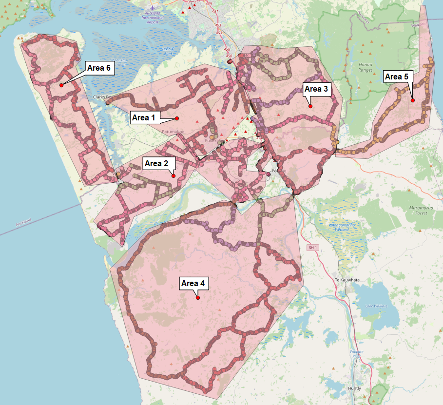
Area 6 (Jan-Feb 2024) Delays due to bad weather
- Te Toro (likely Thursday 29 Feb)
- Manukau Heads has been completed
If you would like to see which parts of your area the drone will fly over, please click on the link below.